We finally waved goodbye to St John's yesterday at 5 pm. We had been sitting on the "wrong" side of the fjord for about eight hours, where the bunker pier is, as we needed to fuel, and boy did we need to fuel! Fueling that lasts for 8 hours, that's some deposit this ship has!
The day was glorious, just a tiny bit of swell with a magnificent coastline lacing our way out. Many people expressed their desire to come back for a hiking holiday. Indeed it is beautiful and probably worth a longer visit. The geology looks pretty nice too :)


Soon after we were out in the open ocean it was dinner time. This is my feel-good spot for this post... maybe not so feel-good for you but certainly for us all, as we entered the mess room and we each were given a whole lobster along with utensils to break it! The mmm and yam noises from all the tables mixed with the cracking shells and oohs and aahs from all the liquids squirting across tables. Seriously somebody explain to me why this is a posh dinner? You have to eat it with your hands, suck the legs, wear a bib...! Not very classy but oh so yummy! For anyone who doesn't know St John's is the place to get lobstern and generally this side of the Atlantic, from Maine in the northern States all the way to St John's. So that was a nice surprise, I can get used to that!

Later on we had our first Science meeting, where our chief scientist, Sebastian, gave a small talk about the objectives of the cruise and why we're doing this and then we went around the table each one introducing themselves and their background and their scientific interests and role on this cruise. Most of the participants are German 17/21, the other four are myself, Chris from England, Jaume from Barcelona and Maxlimer from Venezuela (but works in the States). I only knew Sebastian, Chris and Maxlimer from before, now I'm trying to get to know everyone else.

We spent nearly half a day on transit to our area of interest. Transit usually takes place at full speed and no instruments recording. When we started approaching we switched on all the acoustic devices, multibeam for seafloor mapping and Parasound that records the sub-seafloor layering, sort of like a cross section under the seafloor (think of cake slice and the layers you see vertically once you've cut it), these are called sub-bottom profiles and they help us decide where is a good location to go and throw our corer. The corer is a long steal tube (barrel) in which we put a plastic liner, which looks a lot like the plumbing tubes that are used under the streets. At the top of the steal barrel there are weights that amount to two tonnes of weights, and at the nose of the barrel, we have the cutting shoe, which is a sharp edged cone and inside it is the core catcher which is made out of overlapping blades. The corer is lowered to the seafloor at a speed of 1.5 m per second, under its weight when it reaches the seafloor it penetrates it vertically. The cutting shoe is the one that comes in contact first, sediment enters the tube through the core catcher, whose blades open up to let the sediment in. Once it has reached the maximum depth it can go, we start pulling it out, the blades of the core catcher close and so the sediment stays inside the tube. We can use different lengths of corers, 3 m, 6 m, 9 m, 12 m and increments of 3 up to 24 m. We have 3 m and 6 m barrels that can be connected to make longer corers. The decision about how long a corer to prepare is made based on the sub-bottom profile we have seen. If the character of the sediments looks like they are going to be soft we prepare a long core, if the seafloor character looks like it might be hard, we go for a shorter length. If we are not careful and we send down a long core on a hard seafloor the barrel, upon finding too much resistance might buckle under its weight and bend, and once this happens the barrel is useless. Of course we have some spare ones but we obviously want to avoid destroying our barrels.
So we chose our first core location and we have our first data coming in!
 Launch and Recovery System (LARS) for the corer.
 Corer coming up having gone through the top
14 m of sediment below the seafloor.
So what are we looking for?
In November 1929 there was a relatively severe earthquake in the area offshore Nova Scotia and Newfoundland. The earthquake was a magnitude 7.1 on the Richter scale, Not much was damaged by that earthquake but a couple of hours later a series of events took place; across the towns of Nova Scotia telecommunications were being lost and half an hour later a big tsunami hit their coast cause the death of 28 people. At the time nobody could understand what had happened, but at the beginnng of the 80's scientists tried to understand what had happened and they figured out that the earthquake must have caused a submarine landslide which as it was traversing the submarine slope cut the telecommunication cables one after the other and itself caused the tsunami. Based on the distances between the cables and the time when communications were lost it has been estimated that the slide was moving at a speed of 20 m/s or 100 km/hr! That's pretty fast! When large volumes of sediments move through the sea they displace water out of the way and that's what causes the tsunamis. So it was in the early 80's that scientists first became aware of this process. A lot of studies have followed since then and guess what; the slide has never been found! It appears like many small slides did initiate in many areas on the slope but something like this cannot explain the tsunami that was generated. We have come here to do some more mapping to add to what already exists and take many cores, looking for the deposits of the slide and then work out where on the slope they came from. In order to do that we have to come up with our scientific plan, our strategy if you like. We need to look at what data exist, what they have taught us and use this knowledge to go to the right places and take samples. The area is vast and we only have a month to do this, so we can't just go everywhere. That's why every about 3-4 days the more experienced, more senior people will meet to review what we have so far and what we need to do next. But now I must go and look at the core we collected and see what's inside. Bis spaeter :)

The day was glorious, just a tiny bit of swell with a magnificent coastline lacing our way out. Many people expressed their desire to come back for a hiking holiday. Indeed it is beautiful and probably worth a longer visit. The geology looks pretty nice too :)

That's our ship!!!

Leaving St John's.

The Pilot escorting us out of the fjord. Look at that geology!
Soon after we were out in the open ocean it was dinner time. This is my feel-good spot for this post... maybe not so feel-good for you but certainly for us all, as we entered the mess room and we each were given a whole lobster along with utensils to break it! The mmm and yam noises from all the tables mixed with the cracking shells and oohs and aahs from all the liquids squirting across tables. Seriously somebody explain to me why this is a posh dinner? You have to eat it with your hands, suck the legs, wear a bib...! Not very classy but oh so yummy! For anyone who doesn't know St John's is the place to get lobstern and generally this side of the Atlantic, from Maine in the northern States all the way to St John's. So that was a nice surprise, I can get used to that!

Lobster for dinner! This has never happened to me before!
Later on we had our first Science meeting, where our chief scientist, Sebastian, gave a small talk about the objectives of the cruise and why we're doing this and then we went around the table each one introducing themselves and their background and their scientific interests and role on this cruise. Most of the participants are German 17/21, the other four are myself, Chris from England, Jaume from Barcelona and Maxlimer from Venezuela (but works in the States). I only knew Sebastian, Chris and Maxlimer from before, now I'm trying to get to know everyone else.

My cabin
We spent nearly half a day on transit to our area of interest. Transit usually takes place at full speed and no instruments recording. When we started approaching we switched on all the acoustic devices, multibeam for seafloor mapping and Parasound that records the sub-seafloor layering, sort of like a cross section under the seafloor (think of cake slice and the layers you see vertically once you've cut it), these are called sub-bottom profiles and they help us decide where is a good location to go and throw our corer. The corer is a long steal tube (barrel) in which we put a plastic liner, which looks a lot like the plumbing tubes that are used under the streets. At the top of the steal barrel there are weights that amount to two tonnes of weights, and at the nose of the barrel, we have the cutting shoe, which is a sharp edged cone and inside it is the core catcher which is made out of overlapping blades. The corer is lowered to the seafloor at a speed of 1.5 m per second, under its weight when it reaches the seafloor it penetrates it vertically. The cutting shoe is the one that comes in contact first, sediment enters the tube through the core catcher, whose blades open up to let the sediment in. Once it has reached the maximum depth it can go, we start pulling it out, the blades of the core catcher close and so the sediment stays inside the tube. We can use different lengths of corers, 3 m, 6 m, 9 m, 12 m and increments of 3 up to 24 m. We have 3 m and 6 m barrels that can be connected to make longer corers. The decision about how long a corer to prepare is made based on the sub-bottom profile we have seen. If the character of the sediments looks like they are going to be soft we prepare a long core, if the seafloor character looks like it might be hard, we go for a shorter length. If we are not careful and we send down a long core on a hard seafloor the barrel, upon finding too much resistance might buckle under its weight and bend, and once this happens the barrel is useless. Of course we have some spare ones but we obviously want to avoid destroying our barrels.
So we chose our first core location and we have our first data coming in!


14 m of sediment below the seafloor.
So what are we looking for?
In November 1929 there was a relatively severe earthquake in the area offshore Nova Scotia and Newfoundland. The earthquake was a magnitude 7.1 on the Richter scale, Not much was damaged by that earthquake but a couple of hours later a series of events took place; across the towns of Nova Scotia telecommunications were being lost and half an hour later a big tsunami hit their coast cause the death of 28 people. At the time nobody could understand what had happened, but at the beginnng of the 80's scientists tried to understand what had happened and they figured out that the earthquake must have caused a submarine landslide which as it was traversing the submarine slope cut the telecommunication cables one after the other and itself caused the tsunami. Based on the distances between the cables and the time when communications were lost it has been estimated that the slide was moving at a speed of 20 m/s or 100 km/hr! That's pretty fast! When large volumes of sediments move through the sea they displace water out of the way and that's what causes the tsunamis. So it was in the early 80's that scientists first became aware of this process. A lot of studies have followed since then and guess what; the slide has never been found! It appears like many small slides did initiate in many areas on the slope but something like this cannot explain the tsunami that was generated. We have come here to do some more mapping to add to what already exists and take many cores, looking for the deposits of the slide and then work out where on the slope they came from. In order to do that we have to come up with our scientific plan, our strategy if you like. We need to look at what data exist, what they have taught us and use this knowledge to go to the right places and take samples. The area is vast and we only have a month to do this, so we can't just go everywhere. That's why every about 3-4 days the more experienced, more senior people will meet to review what we have so far and what we need to do next. But now I must go and look at the core we collected and see what's inside. Bis spaeter :)
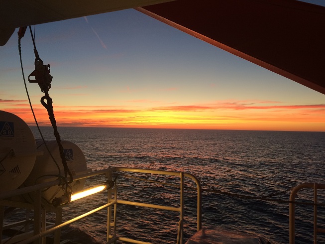
The first sunrise onboard
No comments:
Post a Comment